Christmas Hills
From wiki new
Location:
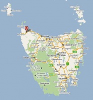
- situated 14km southwest of Smithton at 40° 54' 0" South, 145° 0' 0" East
see Google Map for an enlargement
Opened: 1-OCT-1906 · Closed: 30-APR-1968
Datestamps
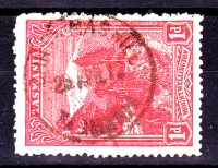
- Earliest recorded date: 26-NOV-1906 · Latest recorded date: 30-AUG-1922
- Rated RR in both the State and Commonwealth periods
- The CDS read CHRISTMAS HILL
Report an earlier or later use of the Type datestamp here
- Error creating thumbnail: File missing
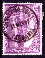
- Earliest recorded date: 6-NOV-1922 · Latest recorded date: 18-APR-1950
- Rated R
Report an earlier or later use of the Type datestamp here
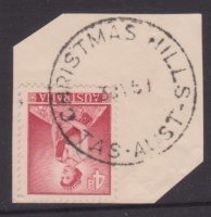
- Earliest recorded date: 28-AUG-1950 · Latest recorded date: 30-APR-1968
- Rated RR
Report an earlier or later use of the Type datestamp here
| To the Index of Tasmanian Post Offices and Postal Markings
To the Tasmanian Datestamp Types main page |
Other Information
Links & References
| To the Index of Tasmanian Post Offices and Postal Markings
To the Tasmanian Datestamp Types main page |
Please contact [mailto: the author] of this page to report any errors and/or omissions or to provide better or 'missing' images, etc.


